Downriver from Arctic Village
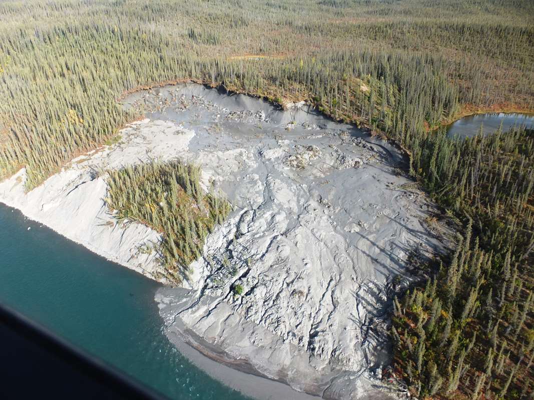
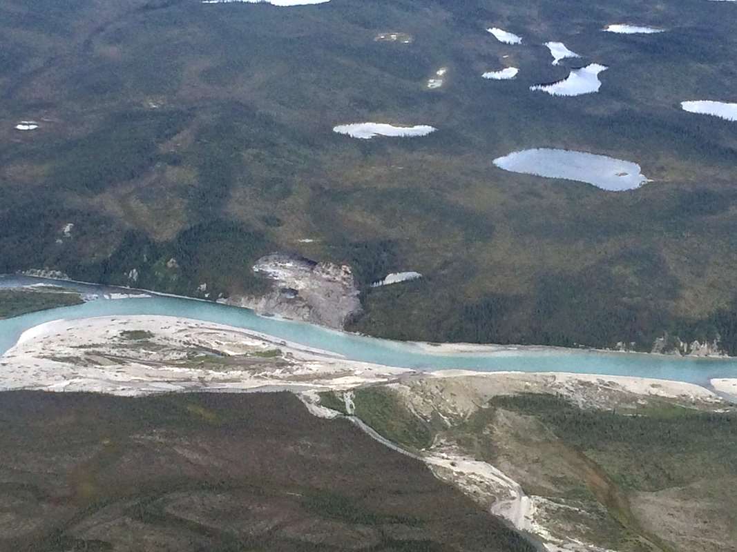
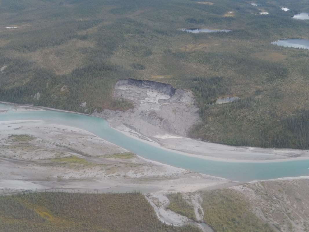
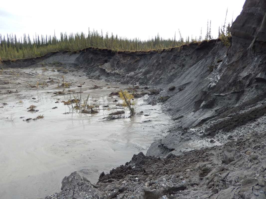
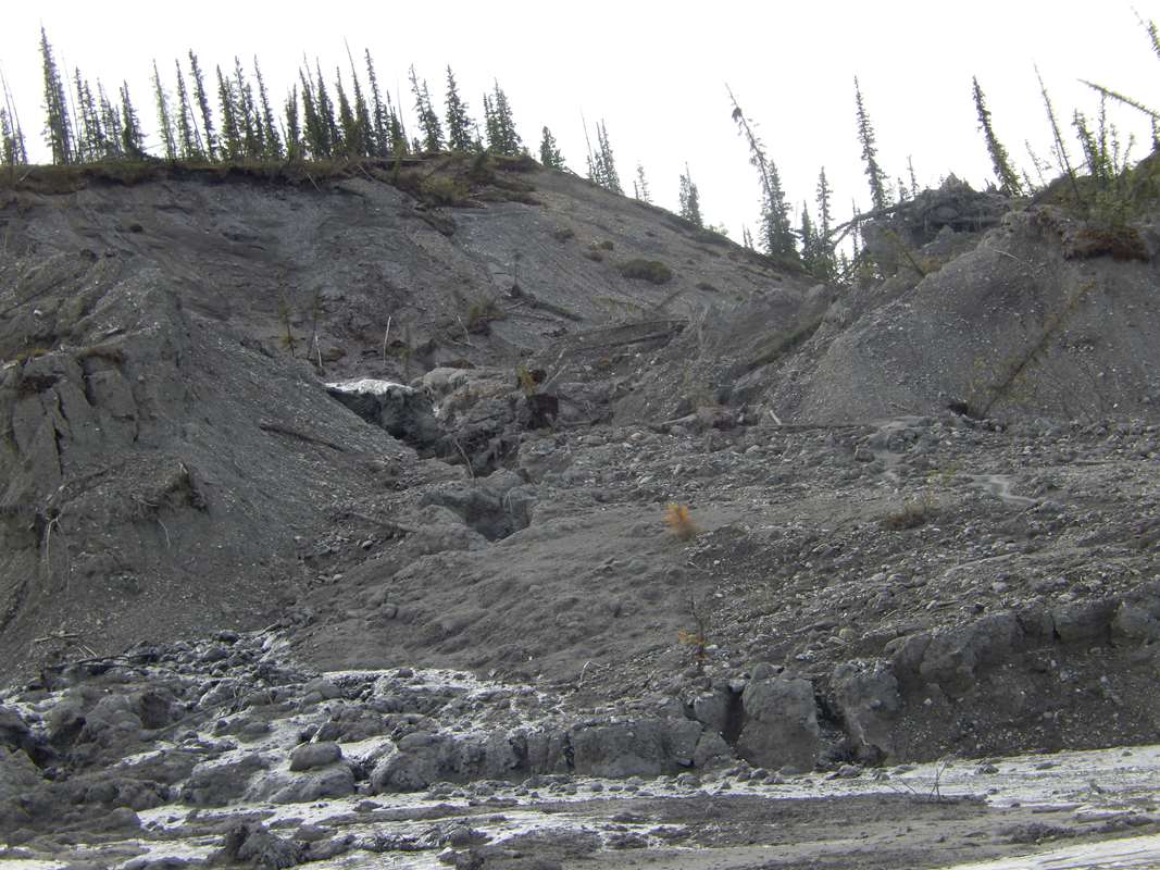
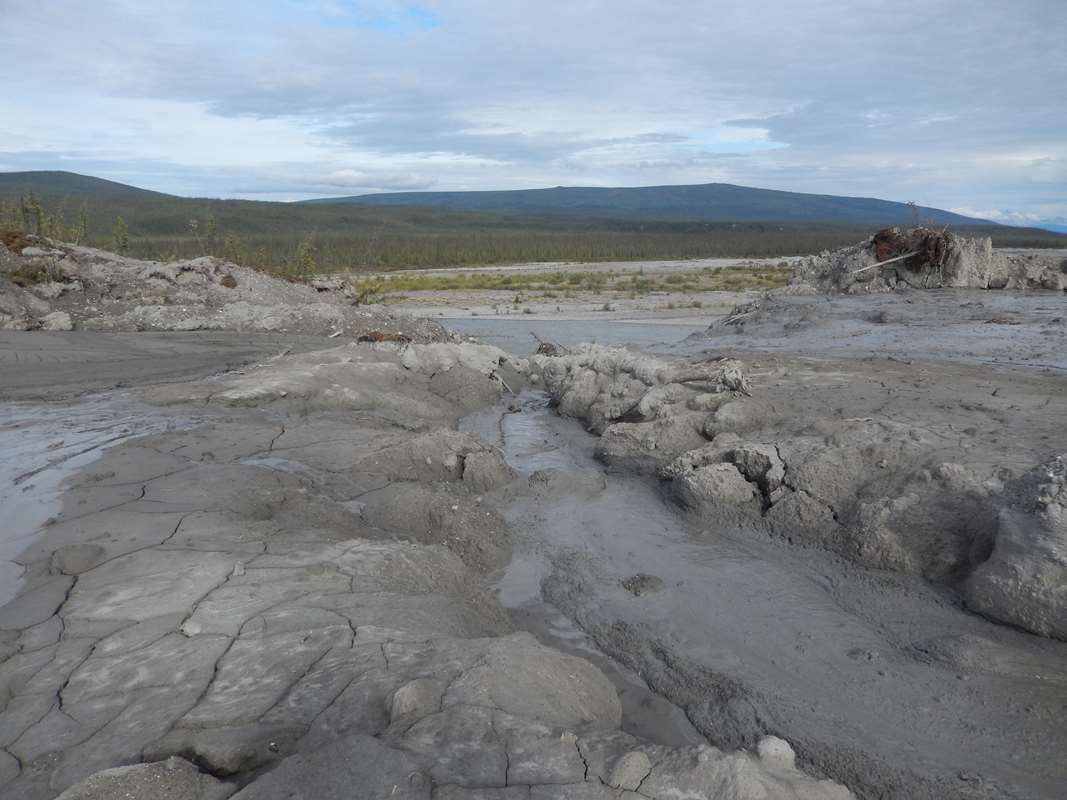
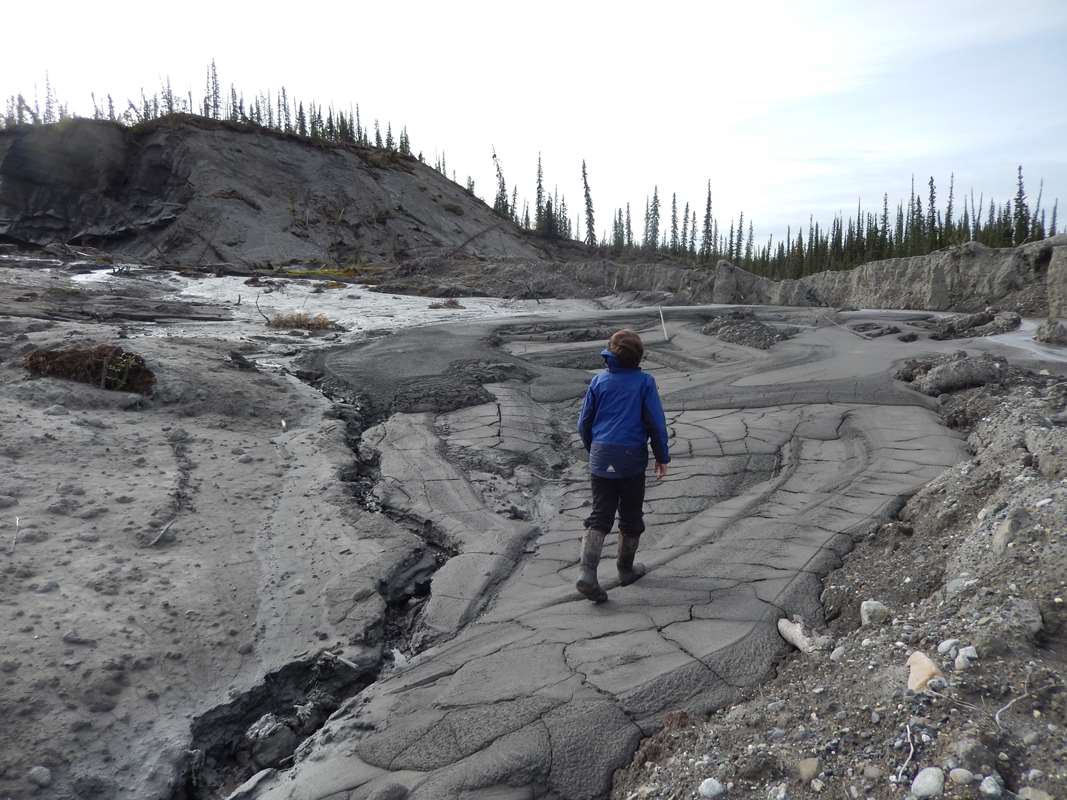
Observation: About 60 miles out of Arctic Village, Alaska down the Chandalar River we found a giant crater caused by the melting of the permafrost. The crater is about the size of a football field. My dad and I climbed up to the crater and saw trees falling and could hear the rock crumbling and falling into a giant pool of quicksand like mud. The crater is dumping lots of dirt, mud, and sand into the river. The river was actually more clear above the crater then below. We saw a total of three craters like this on the river, one up stream and one later down stream. This one was by far the biggest. There was also a lot of erosion all along the the Chandalar. I am wondering how big this crater will get? How much dirt is it putting in the river?
Note: You can see a video of Carter's visit to the crater on YouTube
LEO says: The crater is looks like a thermokarst feature, of which there are many in the thawing Arctic regions of Alaska. Some are caused by climate warming - thawing permafrost and resulting erosion. The questions raised by Carter about how large the feature will grown and the impacts on river water quality are good ones. There are similar large erosion features in other parts of the state (e.g. Selawik River) which have raised concerns about water quality for communities and fish habitat as well as navigation related to obstacles such as trees and sediment such as the development of sand / mud bars. There is also a community health connection, both from the aspect of food security, and that of the challenges related to using turbid rivers as a community water source. We have contacted UAF Permafrost Lab for more information about this site and their consultation.
National Weather Service Consult: Rick Thoman write, "This is quite dramatic. No evidence of recent wildfire activity from the photos makes it seem very likely this is climate related. No point based climate data near here of course, but here's a plot of a late Spring (April-May-June) for the Northeast Interior Climate division. Spring temps in the Interior are pretty strong correlated with snow melt. Since the late 1980s there obviously has been a sea change in temperatures during this season, implying that snow as been melting off earlier, so potentially a longer thaw season. In the absence of wildfire or other disturbance it's this slow grind of persistent warmth that has these big environmental impacts." NOAA NWS Aug 17, 2016
U.S. Fish and Wildlife Consult: Ray Hander writes:"The slump imagery represents a type of thermokarst feature referred to as a retrogressive permafrost thaw slump (slump thawing into an uphill grade). The circum-boreal and circum-arctic regions have been encountering increasing frequency of these and other types of thermokarst features."
UAF Permafrost Laboratory Consult: Vladimir Romanovsky comments from a telephone conversation with LEO Network: "Some of these thermokarst slumps are very active now, growing larger quickly. I just came back from Canada where we looked at several sites like this in the Arctic. Very active. There are also some smaller erosion events happening right now here in Fairbanks. With the warm weather and lots of rain, new sinkholes are developing. It seems that we are in a temperature rising trend again, at a rate that we have not seen since the late 1990s. As to this site on the Chandalar River, the size of these craters depends on the amount of ground ice. If there is a lot of ice they can grow for a long time. Going up slope however, they tend to slow down when they run out of ground ice and can then sometimes stabilize. It is possible to find old slumps like this that are no longer active. My guess is that this is probably related to ice from glacial deposits, and probably the first time this ice has been exposed since the last glacial period, 10,000 years ago. It may run out of ice as it grows and then stabilize. There can be a lot of sediments that are going into the river. Ben Crosby is a good person to talk to about this kind of feature and the effects on the river. Andrew Balser as well as far as permafrost features in the Brooks Range."
See Resources
UAF Permafrost Laboratory
IARPC Collaborations (YouTube) - Terrain Suitability for Hill Slope Thermokarst, (run-time 18:15 min.): Collaboration fosters creativity. Through IARPC (Interagency Arctic Research Policy Committee) Collaborations, scientists from Federal, State, academic, NGO, and industry organizations find talent, share their work, and team up to solve hard problems.
National Park Service, Inventory & Monitoring (I&M) - Thermokarst in Alaska's Arctic: Arctic Network Inventory and Monitoring Program (ANIMP). Permafrost underlies most of Alaska's arctic and affects nearly everything in the arctic ecosystem. Thawing of permafrost produces pits, ponds, lakes, slumps and landslides. Dave Swanson, NPS terrestrial ecologist, takes you on an exploration of thermokarst features (thaw slumps) and explains how NPS monitors change in thermokarst (thaw slumps), in Alaska's most northern parks. For more information on thermokarst and other permafrost related features in Alaska's National Parks, visit Inventory & Monitoring (I&M)
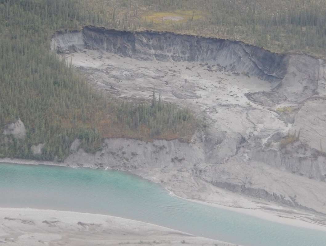
Aerial View [8-10-16] (Photo courtesy of M. Brubaker)
Aerial View [8-21-12] (Photo courtesy of U.S. Fishing Wildlife Serivice)
Aerial View [8-9-14] (Photo courtesy of Janet C. Jorgenson, ANWF)
Aerial View 3 [8-10-16] (Photo courtesy of M. Brubaker)
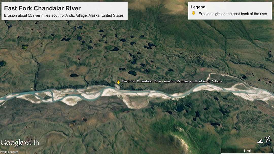
Oblique projection of slump feature [Dec,1969] (Image courtesy of Google Earth - Image Landsat)
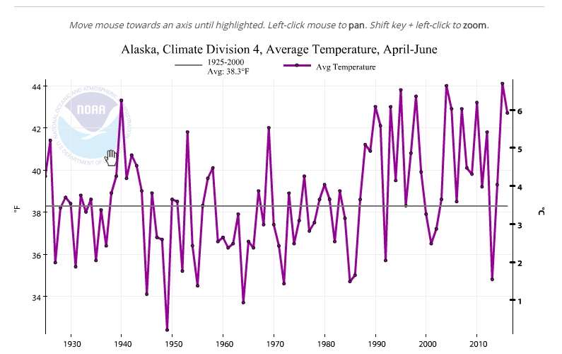
Plot of a late Spring, Apr-May-Jun [8-17-16] (Graph courtesy of the Northeast Interior Climate Division)
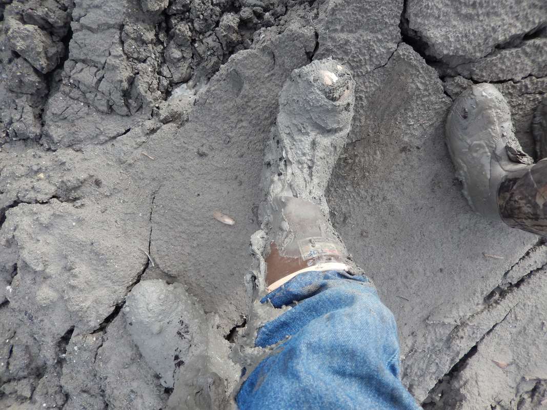
Quick Sand - CAUTION!! [8-10-16] (Photo courtesy of M. Brubaker)
View from inside crater [8-10-15] (Photo courtesy of M. Brubaker)
View from river [8-10-16] (Photo courtesy of M. Brubaker)
View towards river [8-10-16] (Photo courtesy of M. Brubaker)
Walking up to Crater [8-10-16] (Photo courtesy of M. Brubaker)